Here are a few pics from the 1940's showing the various styles of Field System seen on the Eurasian landmass -
It should be noted that these pictures are just a tiny, tiny snapshot of a far larger overall landscape - the entire planet was covered in these fields.
The pics can also give a good idea of how many fields were crammed into a
relatively small area.
There were also different types of Field System layout within each of what we now call 'countries'. For instance, the Netherlands had a wide variety of distinct Field Systems, including the 'Floorboard' type (see the area around 51.934774° 4.869314° as an example); the 'Barcode' type ( see area around 52.303015° 4.684887° as an example); the 'Offset' type (sets of barcode fields, offset at different angles to one another, see 52.823591° 5.005291° as an example) and 'Wave' fields (because the banks of fields look like sea waves that are breaking on the shores of one another, see 51.327034° 3.491634° as an example). All of these Field Types can be found elsewhere in the world, as well as other types, not metioned yet, that are peculiar to a 'country' itself.
If you are interested in this phenomena, I strongly recommend installing Google Earth on a PC or laptop, as it makes referencing what I'm talking about a lot easier to follow - and allows you to see how different many places look just 80 years later.
The numbers at the beginning of each picture are the co-ordinates to paste into GE or whatever viewer you use. Some of the pictures are fairly high resolution, so are better viewed in picture-editing software.
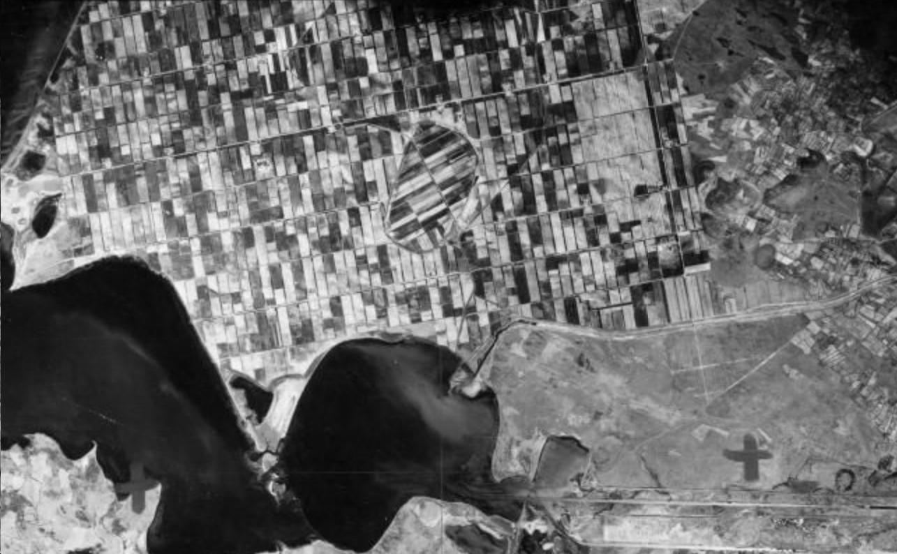
53.779972, 23.652072 - NE of Grodno,
Belarus 1944

- 53.779972, 23.652072 north-east of Grodno.jpg (738.16 KiB) Viewed 20832 times
50.473578, 14.313610 - Sovice,
Czech Republic 1945

- 50.473578, 14.313610 Sovice, Czech Rep 1945.jpg (2.99 MiB) Viewed 20832 times
On the border between what we now call
France and
Belgium - 50.812260, 2.656136 near Poperinge, Belgium 1944

- 50.812260, 2.656136 near Poperinge, Belgium 1944.jpg (427.45 KiB) Viewed 20832 times
50.948703, 2.103987 near Gravelines,
Northern France 1944

- 50.948703, 2.103987 near Gravelines, Northern France 1944.jpg (365.09 KiB) Viewed 20832 times
49.180694, 8.237798_Ottersheim,
Germany_Sept_1952

- 49.180694, 8.237798_Ottersheim, Germany_Sept_1952.jpg (9.67 MiB) Viewed 20832 times
50.391194, 19.576796_near Kwasniow Gorny,
Hungary 1945

- 50.391194, 19.576796_near Kwasniow Gorny, Hungary 1945.jpg (470.06 KiB) Viewed 20832 times
52.511662, 4.667155_Kerkbeek area,
Netherlands 1945 - (shows field system before it was amalgamated and built upon since 1945)

- 52.511662, 4.667155_Kerkbeek area, Netherlands 1945.jpg (1.22 MiB) Viewed 20832 times
50.282728, 21.832682_ Mechowiec area,
Poland 1945

- 50.282728, 21.832682_ Mechowiec area, Poland 1945.jpg (1009.13 KiB) Viewed 20832 times
47.716443, 17.608396 Gyor,
Russia 1943

- 47.716443, 17.608396 Gyor, Russia 1943.jpg (876.57 KiB) Viewed 20832 times
39.698357, 8.552796
Sardinia 1943
- 39.698357, 8.552796_Sardinia 1943.jpg (476.82 KiB) Viewed 20832 times
53.238416, -2.941185 near Liverpool, UK 1940

- 53.238416, -2.941185 near Liverpool, UK 1940.jpg (1.2 MiB) Viewed 20832 times
49.667319, 9.777153_Gemeinholz; Stuttgart; Germany_1953

- 49.667319, 9.777153_Gemeinholz; Stuttgart; Germany_1953.jpg (2.1 MiB) Viewed 20832 times
I'll start going through my pics and post some more up shortly.